 Centre for Polar Studies
imageryBaseMapsEarthCover
Type of resources
Topics
Keywords
Contact for the resource
Provided by
Representation types
Update frequencies
status
-
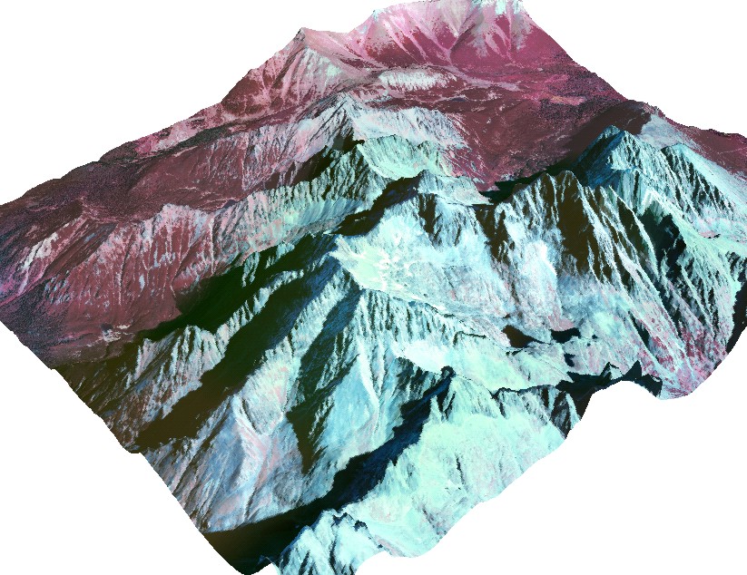
The orthophotomap was prepared on the basis of infrared aerial photographs taken by EUROSENSE in September 1998. The study covers the Dolina Kiezmarskej Bieley vody valley located in the High Tatra Mountains (Slovakia). Cartographic projection: Universal Transverse Mercator, Ellipsoid: WGS 84, Coordinates system: UTM zone 34. The project was financed by No.3P04E 045 23. Editors: Bogdan Gądek, Milan Koren (sen.), Milan Koren (jun.) The project was financed by the Polish Commitee on Scientific Research under term of research grant No. 3P04E 045 23.
-
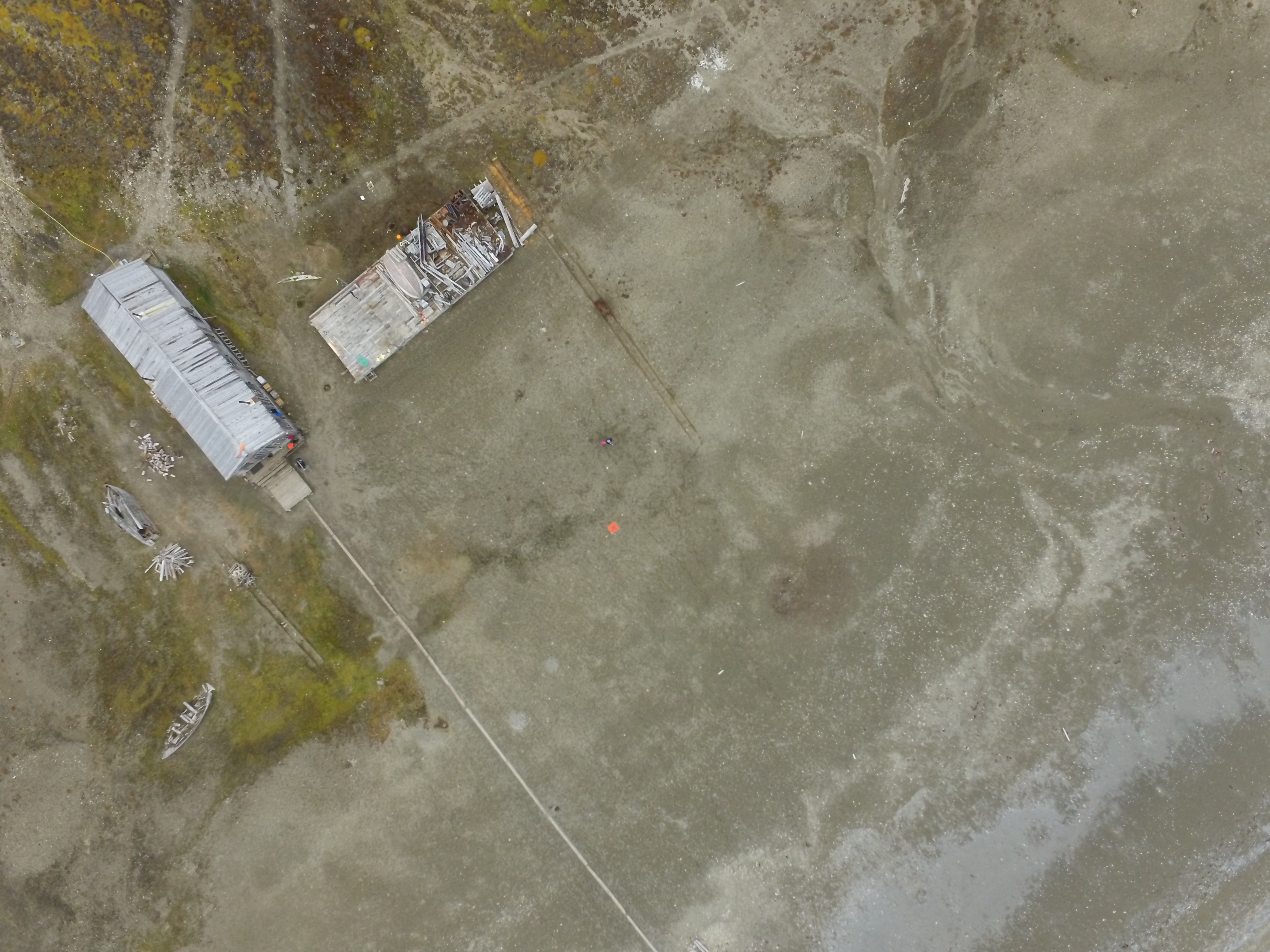
1. Dataset of UAV vertical aerial photos of Calypsobyen obtained from height of: 100m (58 photos), 60m (45 photos) and 30m (59 photos). Used UAV: Phantom 3 Advanced, date of acqusition: 16 Aug 2016. 2. Dataset of UAV vertical aerial photos of Paierlbreen east morain/dead ice obtained from height of 50m (152 photos). Area covered: ~250x~130m (with gaps).Used UAV: Phantom 3 Advanced, date of acqusition: 22 Aug 2016. 3. Dataset of UAV vertical aerial photos of Storbreen, close to Komsa (52 photos). Area covered: ~350x~230m. Used UAV: Phantom 3 Advanced, date of acqusition: 21 Aug 2016. 4. Dataset of UAV vertical aerial photos of Werenskoildbreen's south moraine (300 photos). Area covered: ~200x~350m and ~250x~250m. Used UAV: Phantom 3 Advanced, date of acqusition: 7 Sep 2016.
-

1. Dataset of UAV vertical aerial photos of front and ice melange in the north part of Tunabreen, obtained in spring 2017. Area covered: ~1600x~800m. Used UAV: Phantom 3 Advanced, flight height: 100m. Data obtained during fieldwork supported by Svalbard Science Forum, Arctic Field Grant 2017 with cooperation with University of Maine (USA) and the University Centre in Svalbard (Norway).
-
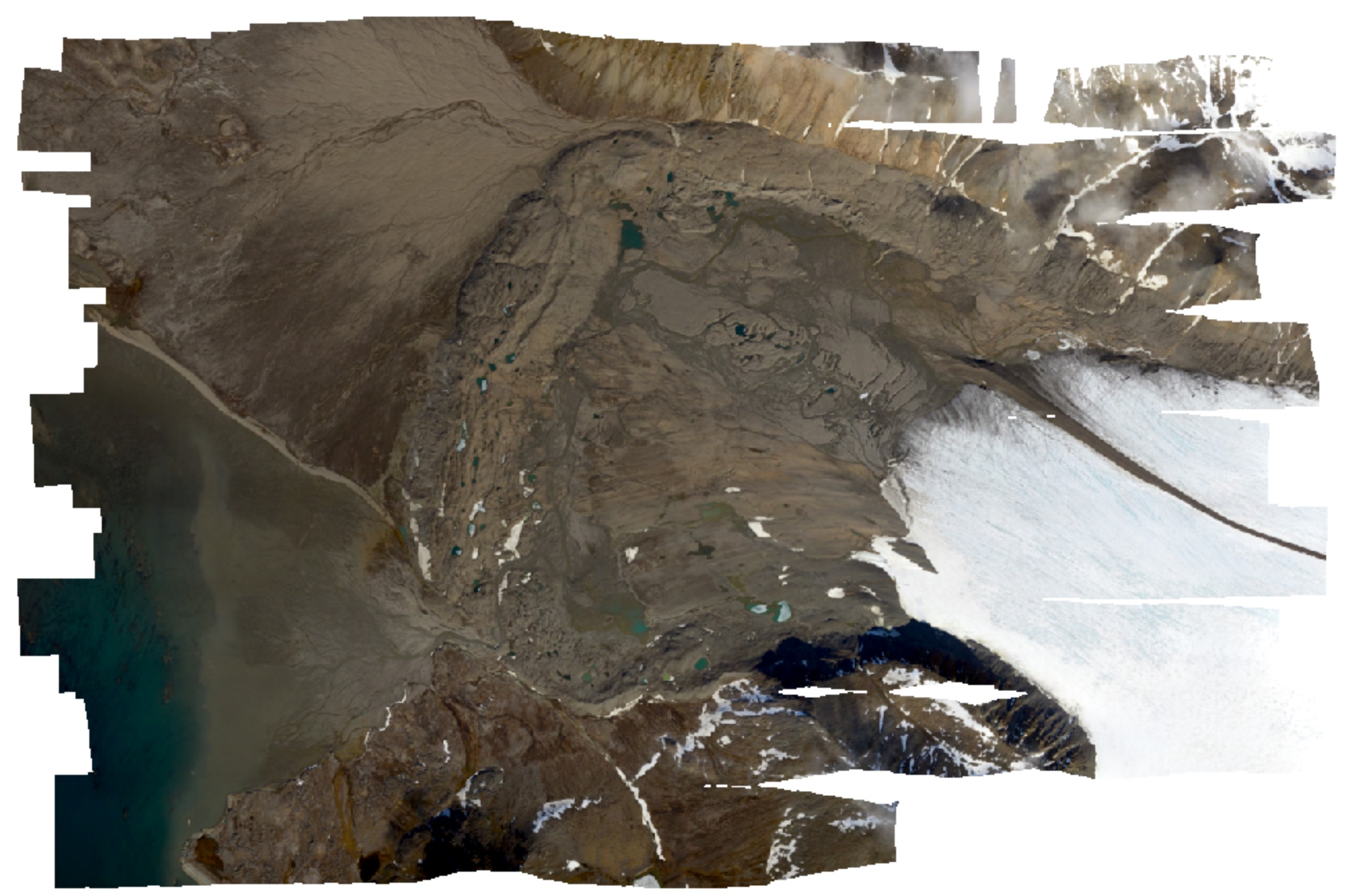
High-resolution orthomosaic derived from aerial images captured in 2020 over Hornsund, Svalbard by Dornier aircraft. The spatial resolution of the orthomosaic is 0.087 m. Aerial images for the area were provided by the SIOS through a dedicated call of proposals (https://sios-svalbard.org/AirborneRS). The dataset is the supplement to the paper: Błaszczyk, M.; Laska, M.; Sivertsen, A.; Jawak, S.D. Combined Use of Aerial Photogrammetry and Terrestrial Laser Scanning for Detecting Geomorphological Changes in Hornsund, Svalbard. Remote Sens. 2022, 14, 601. https://doi.org/10.3390/rs14030601
-
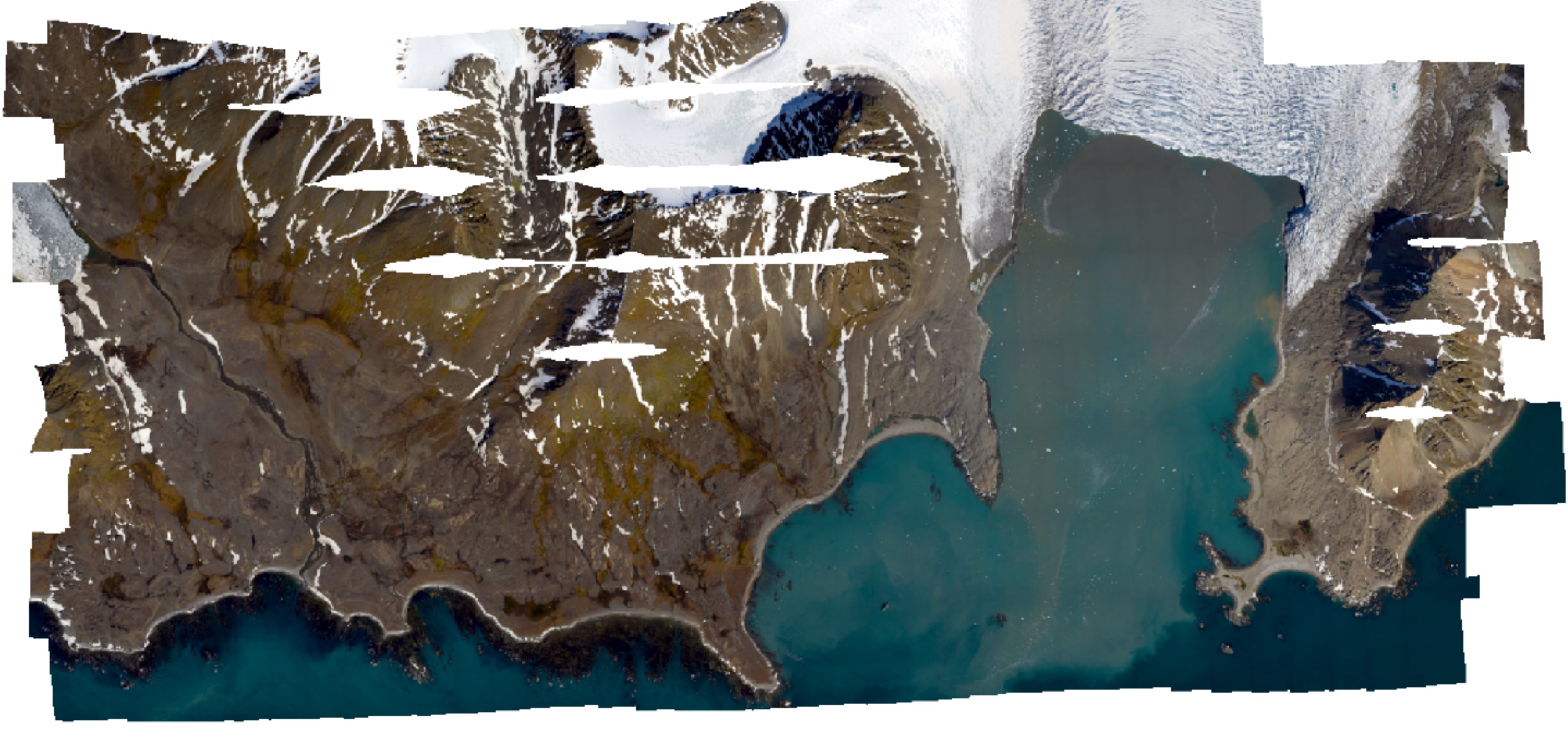
High-resolution orthomosaic derived from aerial images captured in 2020 over Hornsund, Svalbard by Dornier aircraft. The spatial resolution of the orthomosaic is 0.0843 m. Aerial images for the area were provided by the SIOS through a dedicated call of proposals (https://sios-svalbard.org/AirborneRS). The dataset is the supplement to the paper: Błaszczyk, M.; Laska, M.; Sivertsen, A.; Jawak, S.D. Combined Use of Aerial Photogrammetry and Terrestrial Laser Scanning for Detecting Geomorphological Changes in Hornsund, Svalbard. Remote Sens. 2022, 14, 601. https://doi.org/10.3390/rs14030601