irregular
Type of resources
Topics
Keywords
Contact for the resource
Provided by
Years
Representation types
Update frequencies
status
-

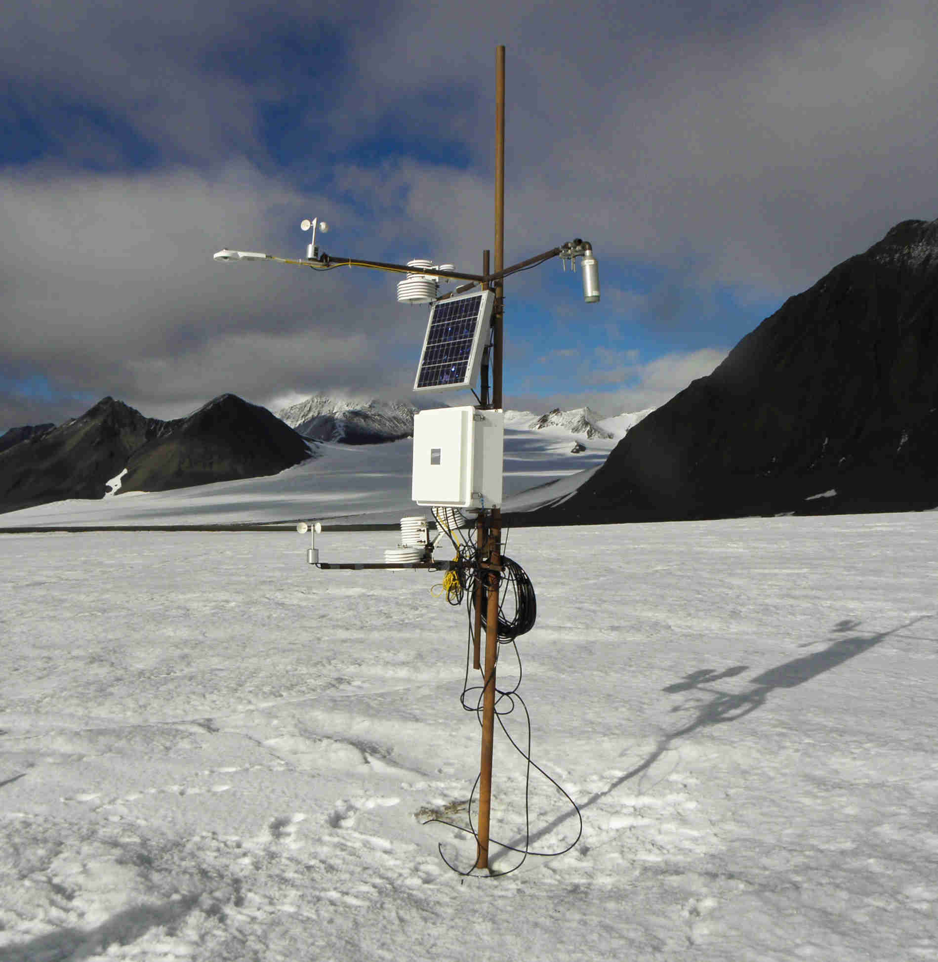
Downwelling shortwave flux in air measurements from AWS located on the Werenskioldbreen. The sensors are installed on a mast that is mounted in the glacier ice. During the season, the distance between the glacier's surface and the sensors increases. The station is serviced at least once a year between March and April.
-

Relative humidity measurements from AWS located on the Werenskioldbreen. The sensors are installed on a mast that is mounted in the glacier ice. During the season, the distance between the glacier's surface and the sensors increases. The station is serviced at least once a year between March and April.
-

Upwelling longwave flux in air measurements from AWS located on the Werenskioldbreen. The sensors are installed on a mast that is mounted in the glacier ice. During the season, the distance between the glacier's surface and the sensors increases. The station is serviced at least once a year between March and April.
-

Hornsund area extracted from different archive data. Detailed description of the source data and accuracy data for glaciers from hydrological basin of Hornsund can be found in: Błaszczyk M., Jania J.A., Kolondra L., 2013: Fluctuations of tidewater glaciers in Hornsund Fiord (Southern Svalbard) since the beginning of the 20th century. Polish Polar Research, 34( 4): 327-352. http://journals.pan.pl/dlibra/publication/114504/edition/99557/content
-

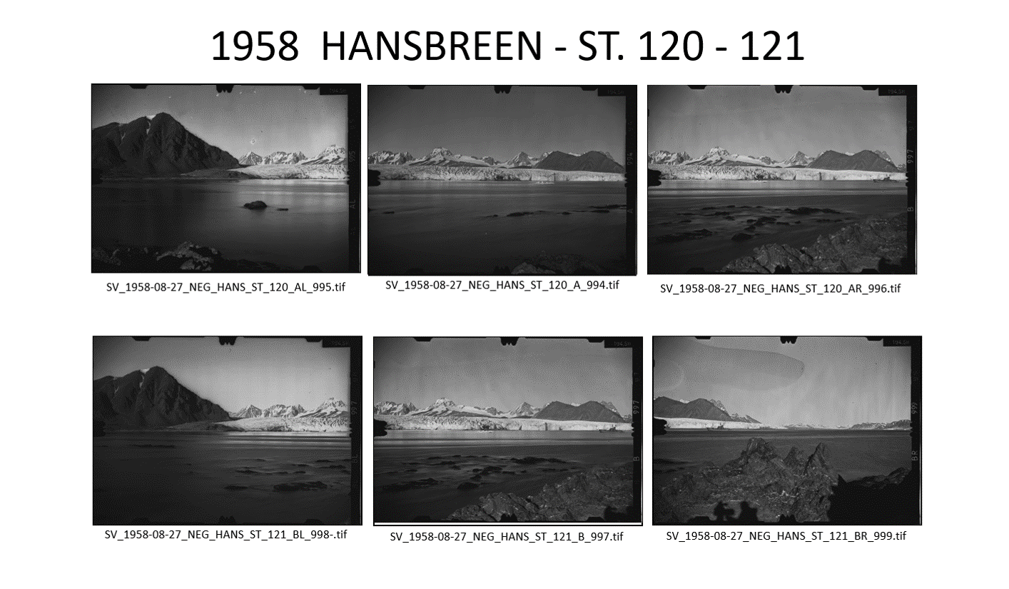
The base contain: 1. List (*xls) of terrophotogrammetric photographs taken by Poles na Spitsbergen from 1934 till 2016: 2. Skaning above photographs with resolution of 2400 dpi, file format *.tif and *.jpg (400 dpi). All photographs were taken by means of instrument type Phototheodolite Zeiss 19/1318 on glass plates. Authors of photographs: Antoni Rogala-Zawadzki, Cezary Lipert, Stanisław Rudowski, Leszek Kolondra, Jacek Jania, Jerzy Wach, Krzysztof Migała, Janusz Karkoszka, Małgorzata Błaszczyk and other unknown members of Polish Expeditions organized by Institute of Geophysic Polish Academy of Science in Station HORNSUND. Fot better identification of all photographs was prepared presentations (in *.pptx and *.pdf formats), where photographs there are arranged in classic form used for terrophotogrammetric stereoscopic photographs: A, AL, AR, B, BL, BR (the meaning of a letter: A - right photogrammetric station and photograph taken in normal case [90°]; B - left photogrammetric station and photograph taken in normal case [90°]; AL - photograph taken from right station in left direction; AR - photograph taken from right station in right direction; BL - photograph taken from left station in left direction; BR - photograph taken from left station in right direction). Other photographs (e.g. panoramic) has additional informations. Boths kind of presentation are prepared in chronological and tematical (for objects) order.
-

Upwelling shortwave flux in air measurements from AWS located on the Werenskioldbreen. The sensors are installed on a mast that is mounted in the glacier ice. During the season, the distance between the glacier's surface and the sensors increases. The station is serviced at least once a year between March and April.
-

High resolution orthophoto images from Geoeye, WorldView-2 and Pléaides processed in OrthoEngine module of PCI Geomatica. Data format: grid, UTM 33X / EGM 2008. Spatial resolution: 0.5 m (panchromatic and pansharpened) and 2 m (multispectral).
-

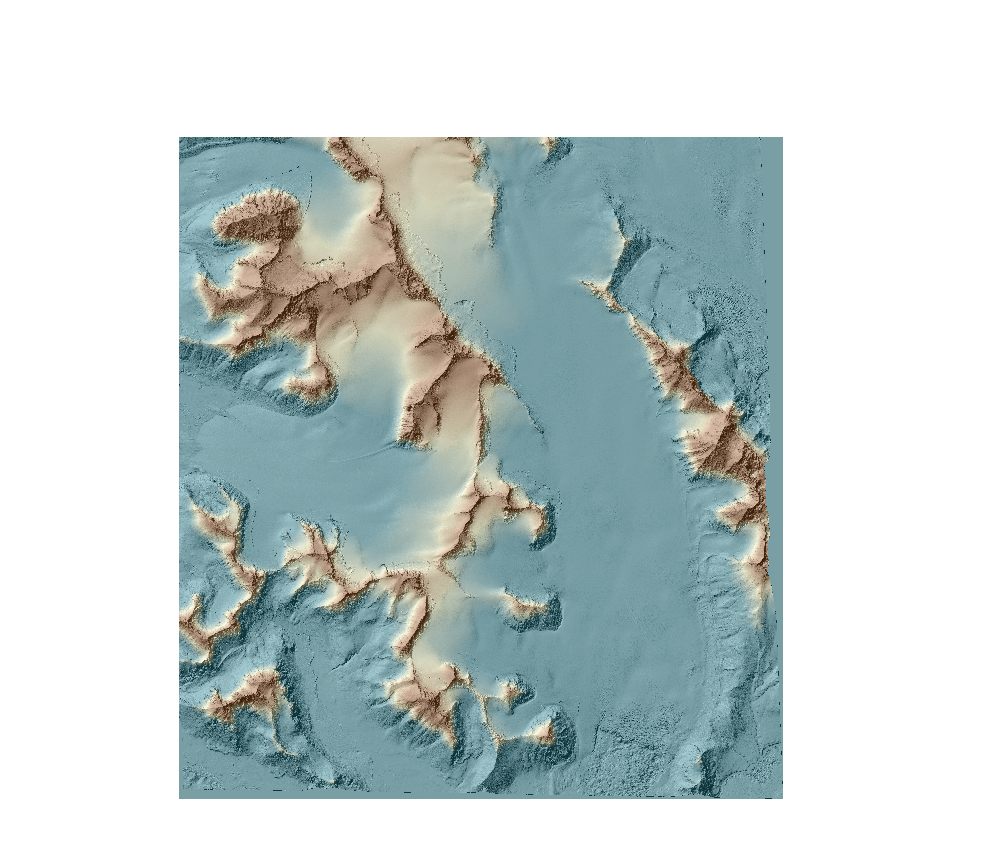
DEMs from WorldView-2 and Pléaides were extracted using the Rational Function Model (RFM). To improve images orientation, one ground control points (GCPs) was used for each stereo pair. Data format: grid (2m), UTM 33X / EGM 2008. DEMs were developed in OrthoEngine module of PCI Geomatica 2016 with the low level of detail and mountainous type of relief.
-

The internal structure of glaciers evolves primarily due to their thermal state, which is influenced by ongoing climate change. Radio-echo sounding is a technique that indirectly identifies water-saturated temperate ice (W-STI) and water-free ice (W-FI) within glaciers. A novel automatic image processing method based on local binarization has been developed to improve the accuracy and efficiency of identifying these layers. Applied to the Arctic glacier Hansbreen from 2007 to 2021, this technique revealed that the glacier’s internal structure evolved from a two-layer system to a nearly homogeneous structure composed mainly of temperate ice (Kachniarz et al. 2025). The dataset contains raw GPR data from 2007 - 2021 taken in the Hansbreen ablation zone used to identify the glacier's internal structure. The profiles are divided into two sections: upper and lower areas. The upper area includes GPR profiles intended to replicate the 2003 GPR profile. The lower area consists of profiles shifted down the glacier, corresponding to the glacier’s movement since 2003. The profile lengths range from 0.7 km to 1.7 km, with the 2016 lower and 2021 upper areas, respectively. In the first season (2007), the GPR profiles were situated at altitudes between 188 and 216 meters above sea level, running transversely to the glacier’s movement. The glacier’s internal structure was examined using GPR system with unshielded 25 MHz, Rough Terrain Antenna (RTA) 30 MHz, and RTA 50 MHz antennas. Image processing Python script based on local binarization and processed image examples have been included in the dataset. See details in Kachniarz et al. 2025. The field data collection and/or processing received grant aid from: Svalbard Integrated Arctic Earth Observing System (SIOS) (SnowInOpt: SIOS Infrastructure Optimisation of the Cal/Val process for the snow research), European Commission Horizon Europe HORIZON-CL5-2024-D1-01-02 (LIQUIDICE: LinkIng and QUantifying the Impacts of climate change on inlanD ICE, snow cover, and permafrost on water resources and society in vulnerable regions) 101184962, the National Centre for Research and Development within the Polish-Norwegian Research Cooperation Programme (AWAKE2 project Pol Nor/198675/17/2013), Polish-Norwegian funding (AWAKE project PNRF-22-AI-1/07), Polish Ministry of Science and Higher Education (GLACIODYN No. IPY/269/2006), PolishNational Centre for Research and Development (SvalGlac project No. NCBiR/PolarCLIMATE-2009/2-2/2010), European Union 7th Framework Programme (ice2sea programme, grant no. 226375. Glaciological data were processed under assessment of the University of Silesia data repository within project Integrated Arctic Observing System (INTAROS, European Union’s Horizon 2020 Research and Innovation Programme—grant No. 727890). The work was supported by the Centre for Polar Studies (the Leading National Research Centre in Earth Sciences for 2014–2018) funding, No. 03/KNOW2/2014. Reference: Kachniarz K., Grabiec M., Wróbel K., Ignatiuk D. 2025: Glacier internal structure revealed by automatic image processing-powered classification of radar images. Applied Geomatics (in review)
-
Since 2010, continuous monitoring of the front zone of the Hansa Glacier with the use of Canon Eos 1000D photo cameras has been carried out (timelapse). Pictures in different periods of time were taken by 3 different cameras. Two cameras (106 and 107) were located on the Fugleberget slope and one (601) on the Baranowskiodden. The periods for which data are available and the interval of taking pictures are shown in Appendix 1.
 Centre for Polar Studies