 Centre for Polar Studies
unknown
Type of resources
Topics
Keywords
Contact for the resource
Provided by
Representation types
Update frequencies
status
-
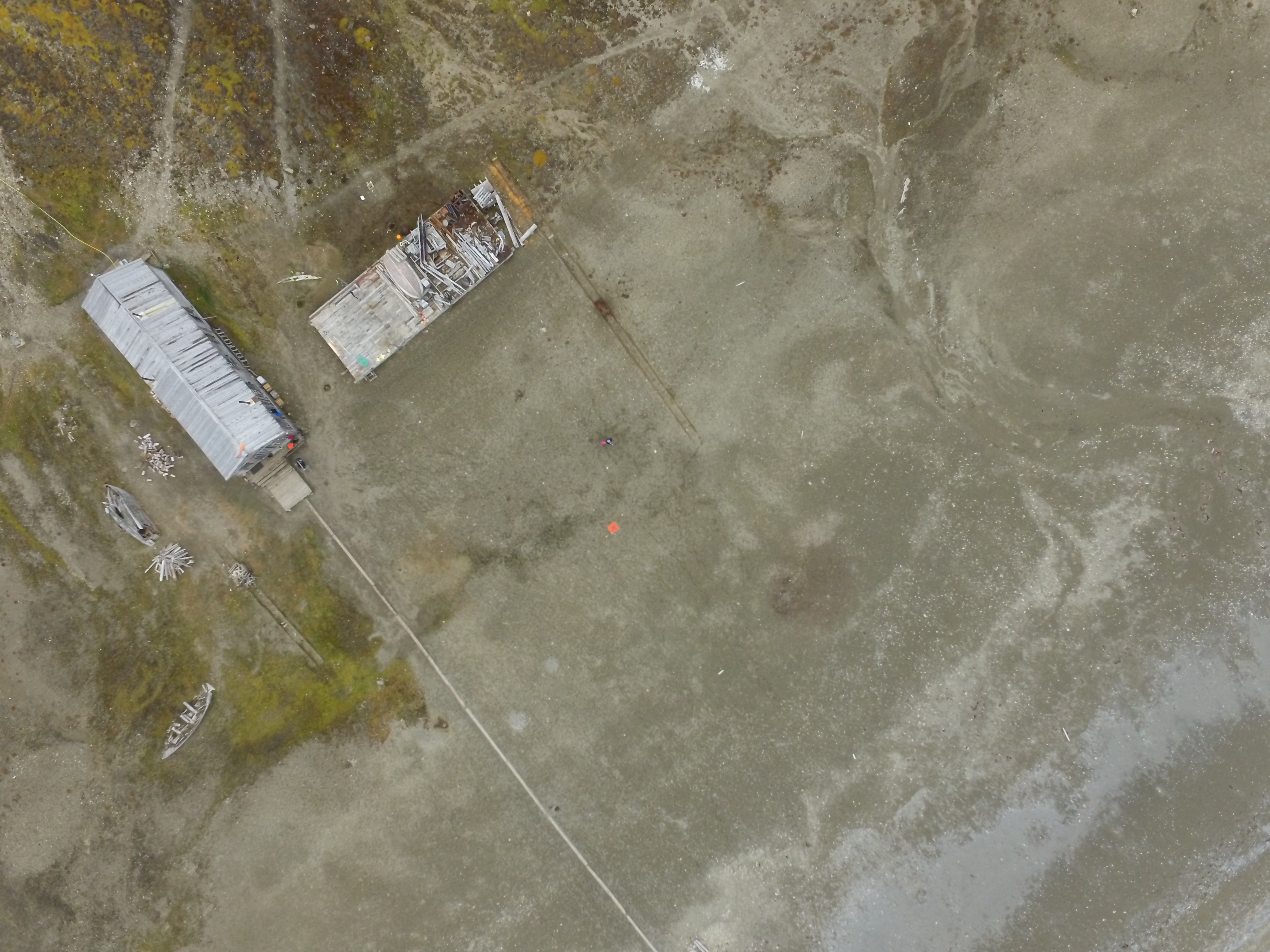
1. Dataset of UAV vertical aerial photos of Calypsobyen obtained from height of: 100m (58 photos), 60m (45 photos) and 30m (59 photos). Used UAV: Phantom 3 Advanced, date of acqusition: 16 Aug 2016. 2. Dataset of UAV vertical aerial photos of Paierlbreen east morain/dead ice obtained from height of 50m (152 photos). Area covered: ~250x~130m (with gaps).Used UAV: Phantom 3 Advanced, date of acqusition: 22 Aug 2016. 3. Dataset of UAV vertical aerial photos of Storbreen, close to Komsa (52 photos). Area covered: ~350x~230m. Used UAV: Phantom 3 Advanced, date of acqusition: 21 Aug 2016. 4. Dataset of UAV vertical aerial photos of Werenskoildbreen's south moraine (300 photos). Area covered: ~200x~350m and ~250x~250m. Used UAV: Phantom 3 Advanced, date of acqusition: 7 Sep 2016.
-
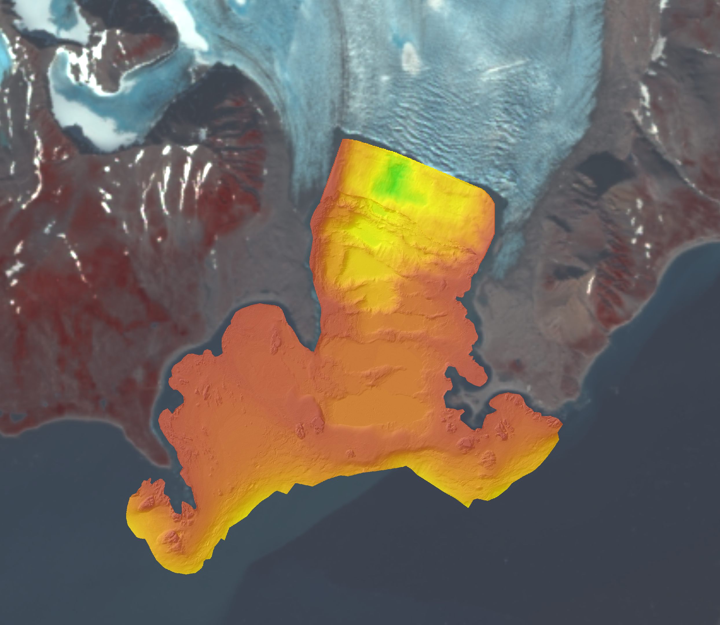
Bathymetry at the front of tidewater glaciers derived from different sources. Bathymetry data in Hansbukta and Burgerbukta have been collected by the Norwegian Hydrographic Service using a multi-beam survey during 2007–2008. Later measurements in Hansbukta were collected with single beam profiling at the Hansbreen front in 2015. Data format: grid (6m), UTM 33X. Single echo-sounding data collected during summer 2011, by the University of Silesia.
-
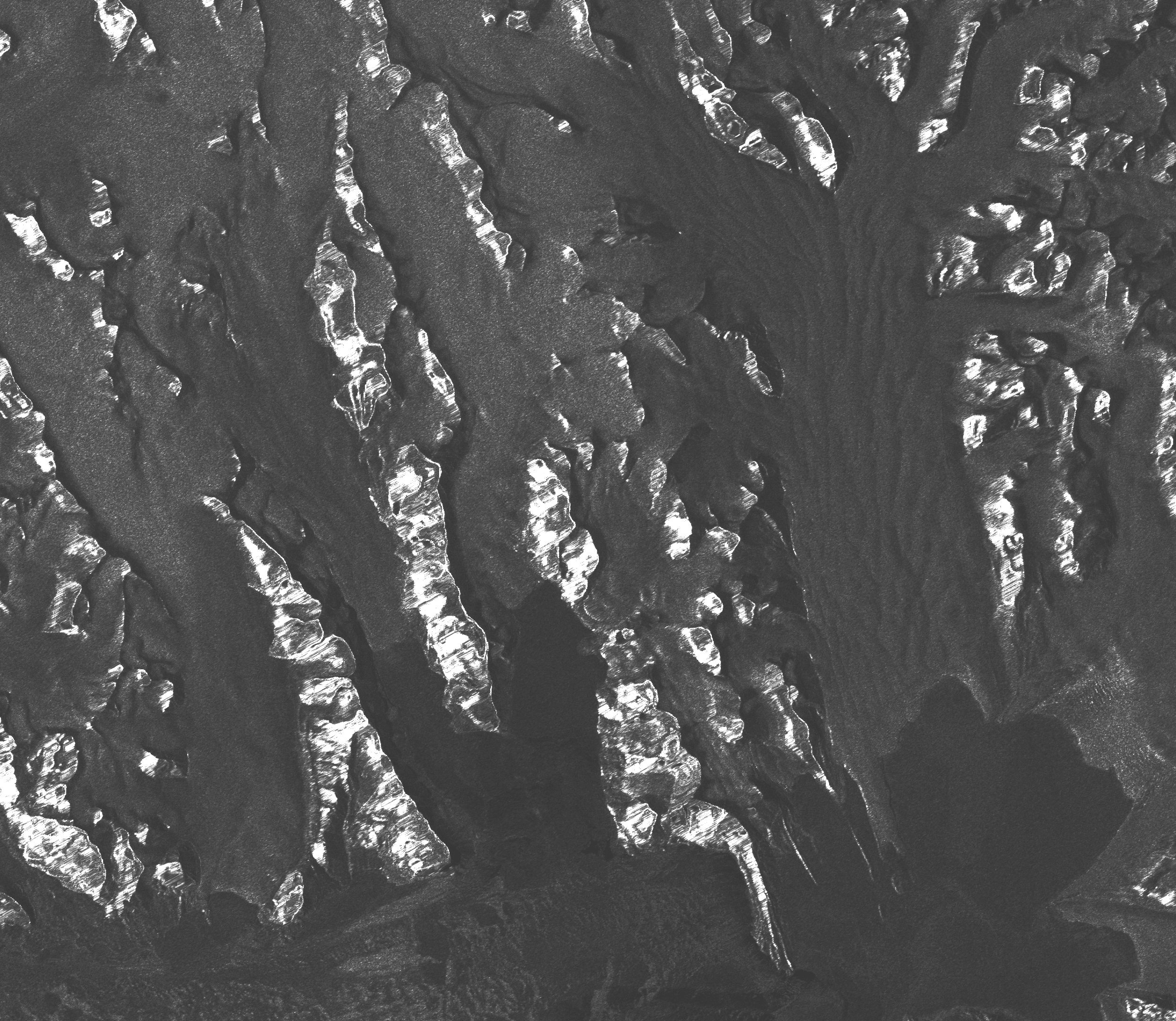
Radar satellite (SAR) images for Hornsund: ERS-1, ERS-2, ENVISAT, ALOS Palsar, TerraSAR-X, TandemX-1, acquired between 1992 and 2014. 210 archival SAR data were provided at the SLC level, so that both radiometric and geometric corrections were applied using the same methods, and with the same digital elevation model (2008 DEM SPOT developed by the IPY-SPIRIT Project; Korona et al., 2009). The SAR data were processed in BEAM (http://www.brockmann-consult.de/cms/web/beam).
-
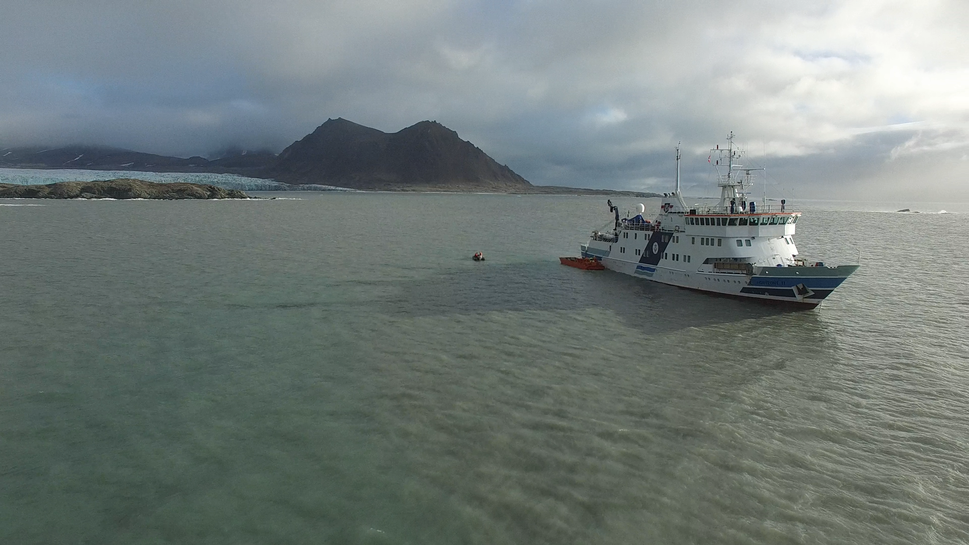
1. Two high-quality UAV movies taken in Hornsund fiord on 15th Sep 2016 with Phantom 3 Advanced usage. The movies are focused on Horyzont II ship during unloading goods to the Polish Polar Station Hornsund. Format file: .MOV. 2. Dataset consist six UAV movies taken in neighborhood of stake no. 4 of Hansbreen, one taken in the vicinty of stake no. 6 of Hansbreen and two on Tuvbreen. The movies from stake no. 4 show the ablation zone, crevasses, glaciers in the area and a team of University of Silesia scientists during maintanance of automatic weather station (AWS). The movie from stake no. 6 presents the surface of Hansbreen towards accumulation zone. The movies from Tuvbreen show the area around, surface of the glacier and University of Silesia team. UAV: Phantom 3 Advanced. Format file: .MOV. 3. One high-quality UAV movie taken from West morain of Paierbreen 22nd Aug 2016 with Phantom 3 Advanced usage. The movie is focused on the front of Paierlbreen. Format file: .MOV. 4. Two high-quality UAV movies taken on Silesiabreen 23nd Aug 2016 with Phantom 3 Advanced usage. The movie is focused on the snowline of Silesiabreen, University of Silesia scietists while fieldwork and neighbourhood. 5. UAV movie of Storbreen upper ablation area in 21st Aug 2016. 6. Three high-quality UAV movies taken from vicinity of Treskelen in Hornsund on 12 Sep 2016 with Phantom 3 Advanced usage. The movies are focused on the University of Silesia team during automatic weather station maintanance, sailing boat operated by scientists and Hornsund fiord. 7. A high-quality UAV movie taken from vicinity of Brateggbreen on 5 Sep 2016 with Phantom 3 Advanced usage. The movie is focused on Brateggbreen front and its proglacial lake. Format file: .MOV. 8. UAV movies of Werenskoildbreen front and morain in summer 2016
-
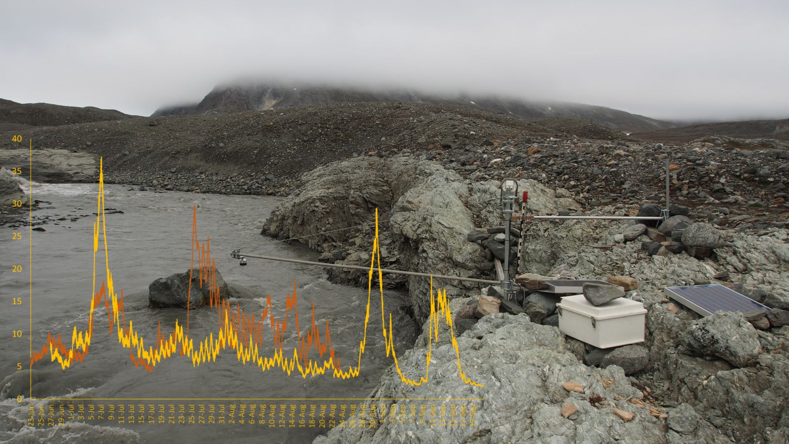
Sensor HOBO U20-001-03 Water Level, Onset Computer Corporation measuring water (1) and air (2) pressure at the hydrometric station of the Werenskioldbreen (77B004'23.9"N 15B010'05.4"E) / 10-min intervals in 2019 and 2020. The dataset includes part of the results from the project “Hindcasting and projections of hydro-climatic conditions of Southern 350 Spitsbergen” (grant no. 2017/27/B/ST10/01269) financed by the Polish National Science Centre.
-
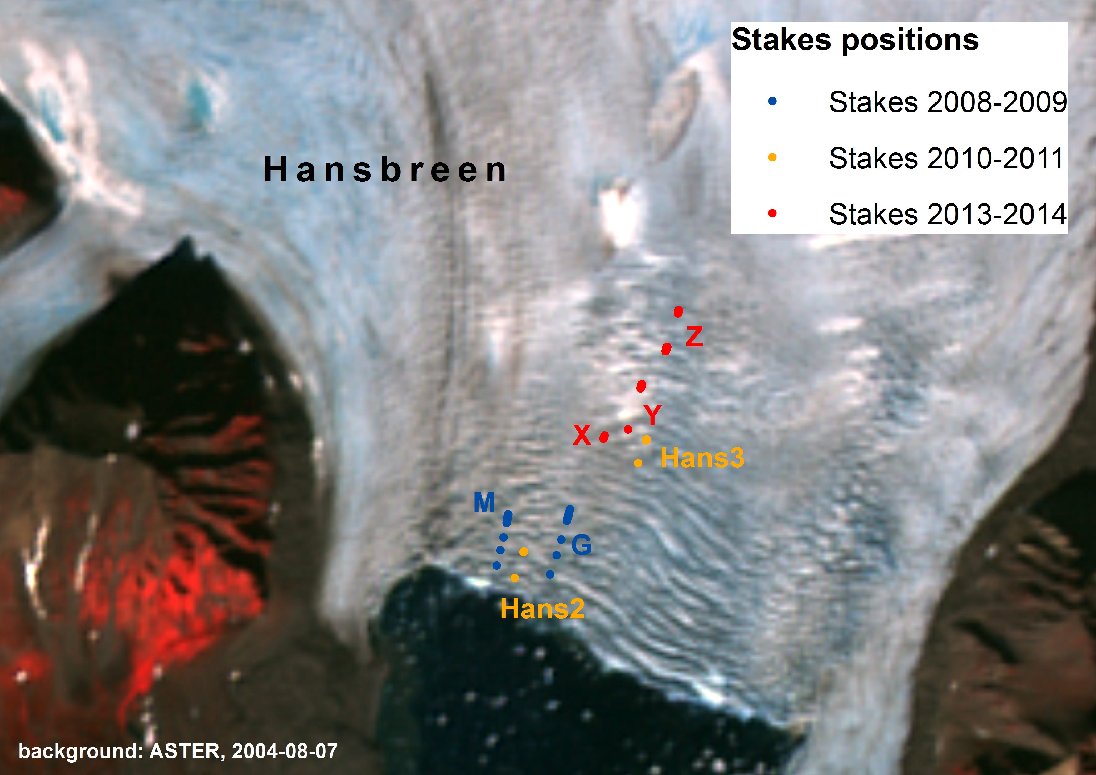
Glacier velocities are derived from the displacements of stakes installed close to the front of Hansbreen. Measurements of stakes position were conducted in 2008-2009, 2010-2011, 2013-2014 and 2015, with precise dGPS receiver (Leica 1230, accuracy ±5cm) and with time intervals from 3 hours to a few days.
-

1. Dataset of UAV vertical aerial photos of front and ice melange in the north part of Tunabreen, obtained in spring 2017. Area covered: ~1600x~800m. Used UAV: Phantom 3 Advanced, flight height: 100m. Data obtained during fieldwork supported by Svalbard Science Forum, Arctic Field Grant 2017 with cooperation with University of Maine (USA) and the University Centre in Svalbard (Norway).
-
1. One UAV movie taken of Paierlbreen in spring 2017 with Phantom 3 Advanced usage. The movie is focused on the front of the glacier and the area around.