denominator
50000
Type of resources
Topics
Keywords
Contact for the resource
Provided by
Update frequencies
status
Scale
From
1
-
1
/
1
-

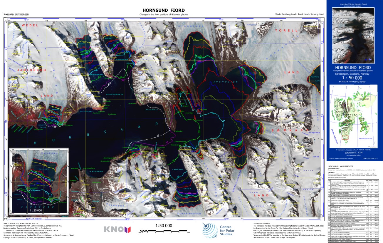
The ortophotomap of Hornsund Fiord with changes to the front positions of tidewater glaciers. The front positions are based on different cartographical maps and satellite data. The base map is Sentinel 2 satellite image acquired on 6 July 2018. Citation: Kolondra L., 2018. Hornsund Fiord - Changes to the front positions of tidewater glaciers. University of Silesia, Faculty of Earth Sciences.
 Centre for Polar Studies