 Polish Polar DataBase

Type of resources
Available actions
Topics
Keywords
Contact for the resource
Provided by
Years
Formats
Representation types
Update frequencies
status
Scale
-
https://egusphere.copernicus.org/preprints/2023/egusphere-2023-115/
-
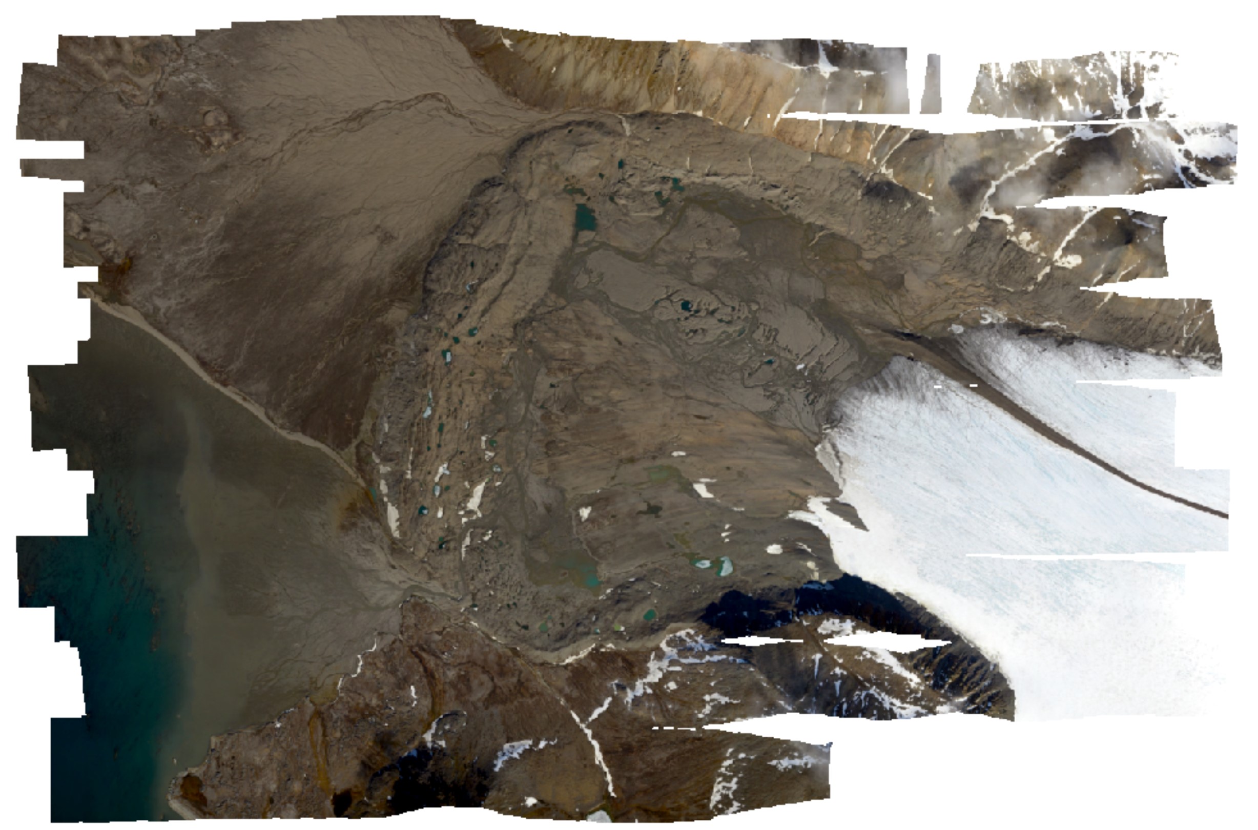
High-resolution orthomosaic derived from aerial images captured in 2020 over Hornsund, Svalbard by Dornier aircraft. The spatial resolution of the orthomosaic is 0.087 m. Aerial images for the area were provided by the SIOS through a dedicated call of proposals (https://sios-svalbard.org/AirborneRS). The dataset is the supplement to the paper: Błaszczyk, M.; Laska, M.; Sivertsen, A.; Jawak, S.D. Combined Use of Aerial Photogrammetry and Terrestrial Laser Scanning for Detecting Geomorphological Changes in Hornsund, Svalbard. Remote Sens. 2022, 14, 601. https://doi.org/10.3390/rs14030601
-
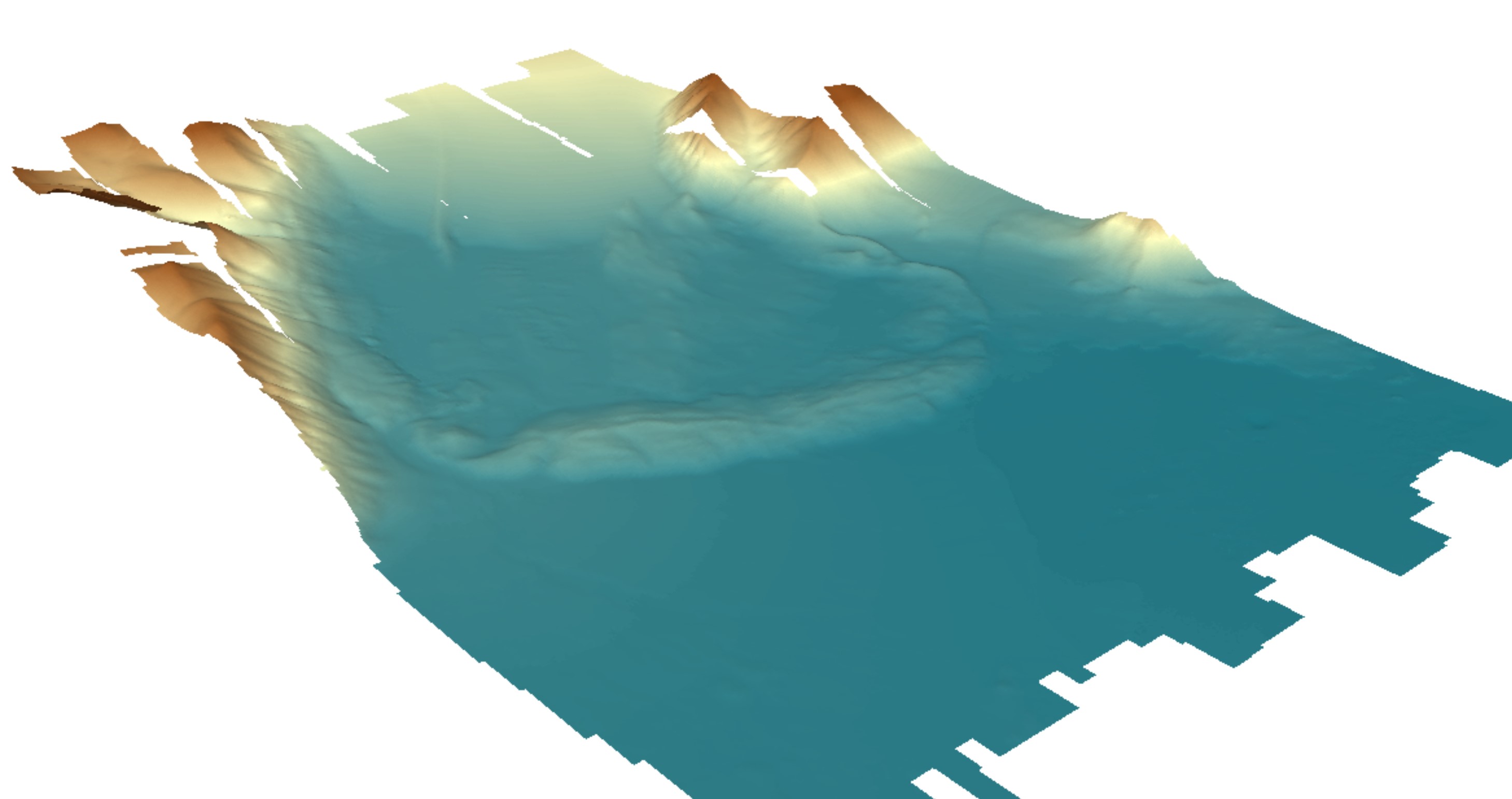
Digital elevation model (DEM) with high spatial resolution derived from aerial images captured in 2020 over Hornsund, Svalbard by Dornier aircraft. The spatial resolution of the orthomosaic is 0.174 m. Aerial images for the area were provided by the SIOS through a dedicated call of proposals (https://sios-svalbard.org/AirborneRS). The dataset is the supplement to the paper: Błaszczyk, M.; Laska, M.; Sivertsen, A.; Jawak, S.D. Combined Use of Aerial Photogrammetry and Terrestrial Laser Scanning for Detecting Geomorphological Changes in Hornsund, Svalbard. Remote Sens. 2022, 14, 601. https://doi.org/10.3390/rs14030601
-
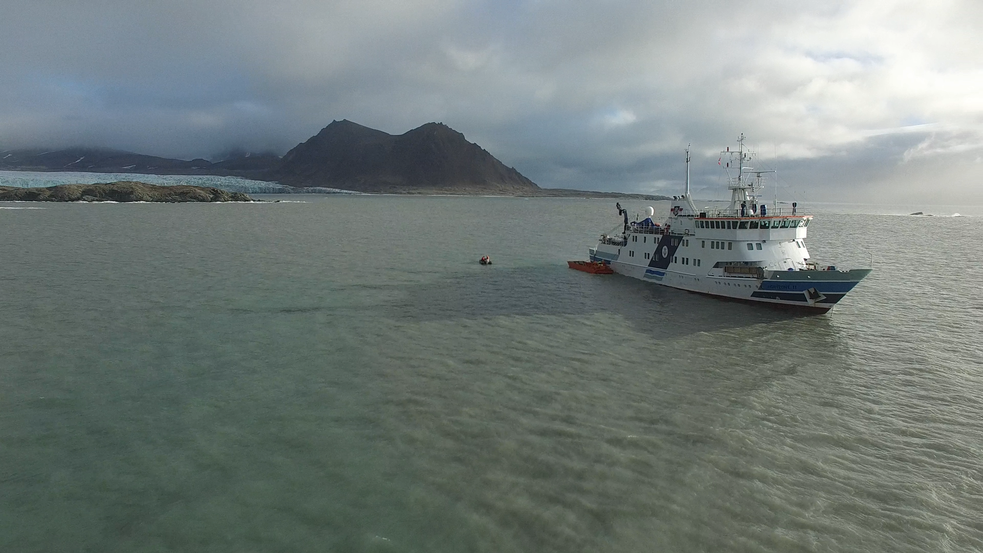
1. Two high-quality UAV movies taken in Hornsund fiord on 15th Sep 2016 with Phantom 3 Advanced usage. The movies are focused on Horyzont II ship during unloading goods to the Polish Polar Station Hornsund. Format file: .MOV. 2. Dataset consist six UAV movies taken in neighborhood of stake no. 4 of Hansbreen, one taken in the vicinty of stake no. 6 of Hansbreen and two on Tuvbreen. The movies from stake no. 4 show the ablation zone, crevasses, glaciers in the area and a team of University of Silesia scientists during maintanance of automatic weather station (AWS). The movie from stake no. 6 presents the surface of Hansbreen towards accumulation zone. The movies from Tuvbreen show the area around, surface of the glacier and University of Silesia team. UAV: Phantom 3 Advanced. Format file: .MOV. 3. One high-quality UAV movie taken from West morain of Paierbreen 22nd Aug 2016 with Phantom 3 Advanced usage. The movie is focused on the front of Paierlbreen. Format file: .MOV. 4. Two high-quality UAV movies taken on Silesiabreen 23nd Aug 2016 with Phantom 3 Advanced usage. The movie is focused on the snowline of Silesiabreen, University of Silesia scietists while fieldwork and neighbourhood. 5. UAV movie of Storbreen upper ablation area in 21st Aug 2016. 6. Three high-quality UAV movies taken from vicinity of Treskelen in Hornsund on 12 Sep 2016 with Phantom 3 Advanced usage. The movies are focused on the University of Silesia team during automatic weather station maintanance, sailing boat operated by scientists and Hornsund fiord. 7. A high-quality UAV movie taken from vicinity of Brateggbreen on 5 Sep 2016 with Phantom 3 Advanced usage. The movie is focused on Brateggbreen front and its proglacial lake. Format file: .MOV. 8. UAV movies of Werenskoildbreen front and morain in summer 2016
-
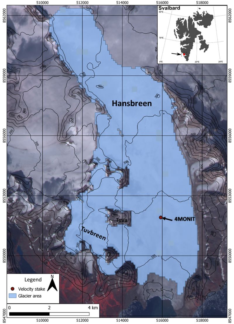
Hansbreen velocity is measured with a Global Navigation Satellite Systems (GNSS) receiver that sampled location every 3 hours at stake 4MONIT located approximately 3.5 km upstream of the glacier terminus (N77°02’ E15°28’). Monitoring of the glacier is conducted by Institute of Geophysics Polish Academy of Science. We calculate the daily speed based on each midnight positions (with a horizontal accuracy of ±4 cm).
-
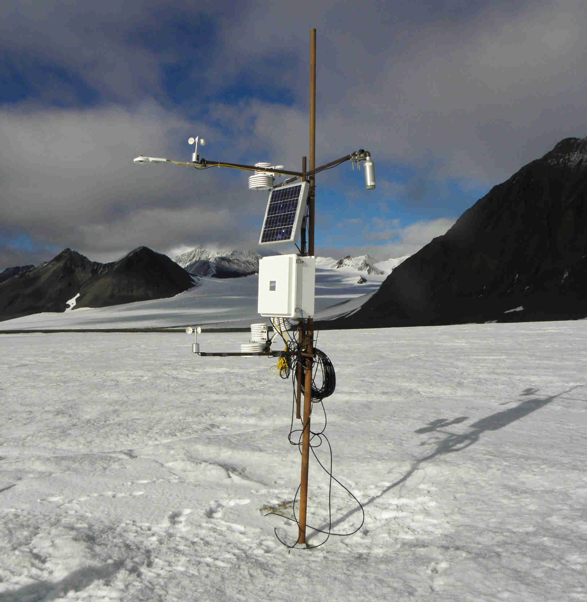
Air temperature is provided by AWS 4 (N77°02' E15°38', 183 m). Air temperature comes from a Campbell Scientific 107 sensor at +/- 0.1° C resolution and sampled every 10 minutes, averaged to daily resolution in post-processing.
-
Ice condition directly at the Hansbreen front is obtained from visual interpretation of oblique pictures taken at 3 h intervals by Canon EOS 1000D time-lapse photography (Figure 1) for the period 2010–2015 (http://ppdb.us.edu.pl/geonetwork/srv/pol/catalog.search;jsessionid=muhaqbum8pz21xknjo0crhodn?node=srv#/metadata/cf6a17fd-ec3a-4ff6-8232-67a0dc5957d4) The database is the supplement to the paper: Małgorzata Błaszczyk, Jacek A. Jania, Michał Ciepły, Mariusz Grabiec, Dariusz Ignatiuk, Leszek Kolondra, Aleksandra Kruss, Bartłomiej Luks, Mateusz Moskalik, Tadeusz Pastusiak, Agnieszka Strzelewicz, Waldemar Walczowski, Tomasz Wawrzyniak. “Factors controlling terminus position of Hansbreen, a tidewater glacier in Svalbard”, Journal of Geophysical Research - Earth Surface, https://doi.org/10.1029/2020JF005763.
-
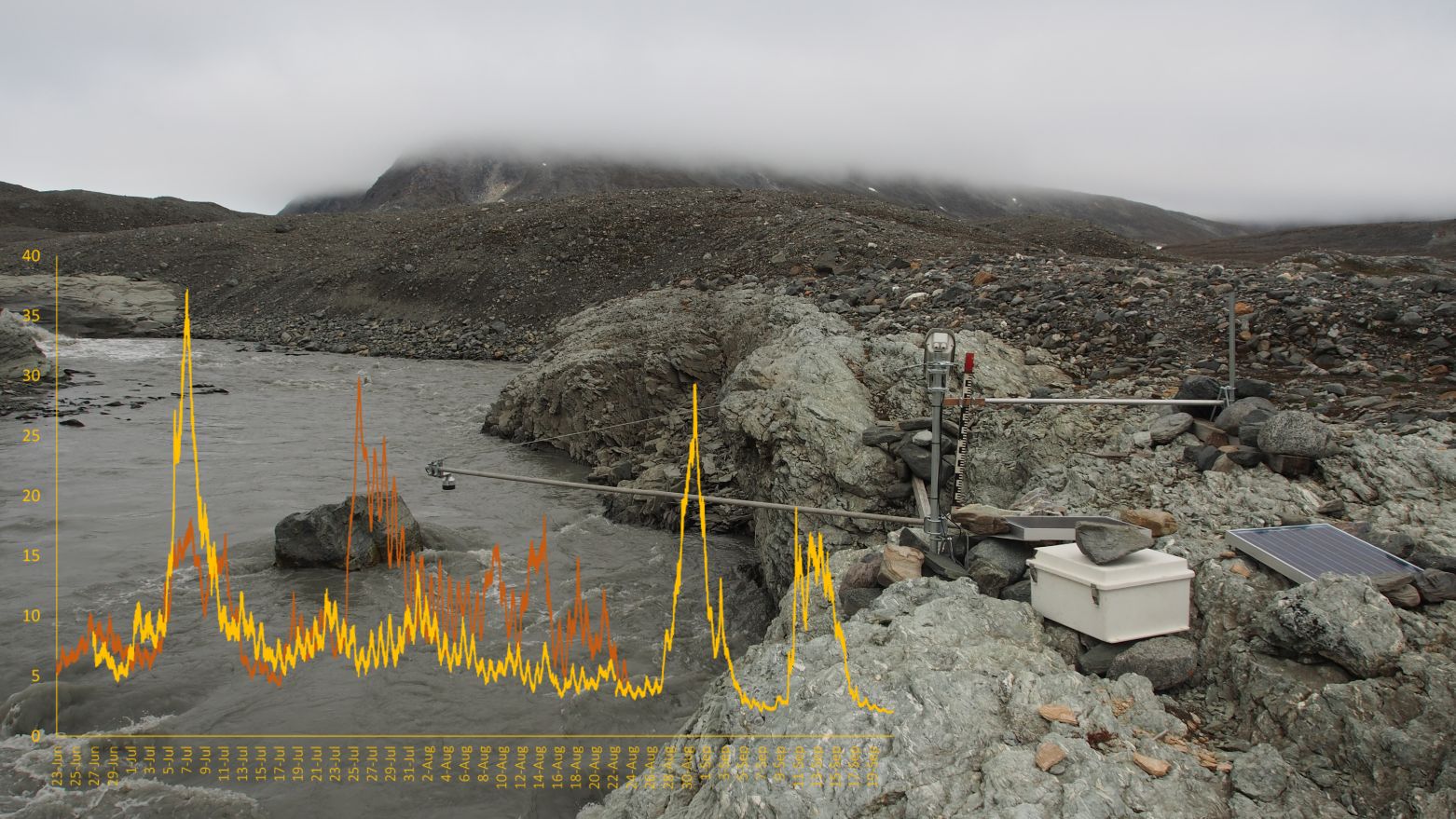
Sensor HOBO U20-001-03 Water Level, Onset Computer Corporation measuring water (1) and air (2) pressure at the hydrometric station of the Werenskioldbreen (77B004'23.9"N 15B010'05.4"E) / 10-min intervals in 2019 and 2020. The dataset includes part of the results from the project “Hindcasting and projections of hydro-climatic conditions of Southern 350 Spitsbergen” (grant no. 2017/27/B/ST10/01269) financed by the Polish National Science Centre.
-
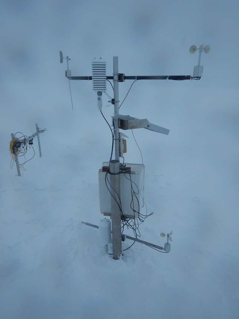
Wind speed measurements from AWS located on the Werenskioldbreen. The sensors are installed on a mast that is mounted in the glacier ice. During the season, the distance between the glacier's surface and the sensors increases. The station is serviced at least once a year between March and April.
-
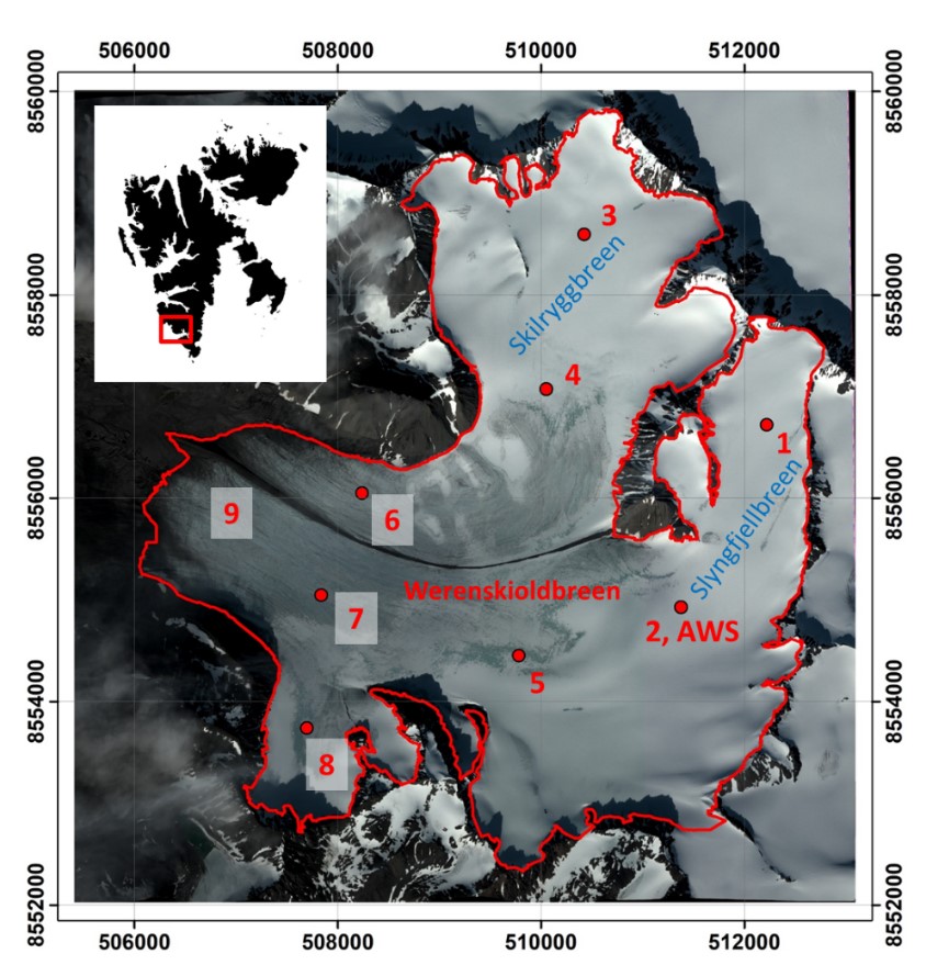
The dataset includes point winter and summer mass balance measurements on ablation stakes in 2009-2020 and the calculated point annual mass balance. The dataset includes part of the results from the project “Hindcasting and projections of hydro-climatic conditions of Southern 350 Spitsbergen” (grant no. 2017/27/B/ST10/01269) financed by the Polish National Science Centre, “Arctic climate system study of ocean, sea ice, and glaciers interactions in Svalbard area”—AWAKE2 (Pol-Nor/198675/ 17/2013), supported by the National Centre for Research and Development within the Polish–Norwegian Research Cooperation Programme and the SvalGlac—Sensitivity of Svalbard glaciers to climate change, the ESF Project, the project Integrated Arctic 355 Observing System (INTAROS)- Horizon 2020, the ice2sea 7th FP projects. The studies were carried out as part of the scientific activity of the Centre for Polar Studies (University of Silesia in Katowice) with the use of research and logistic equipment of the Polar Laboratory of the University of Silesia in Katowice.