 Polish Polar DataBase
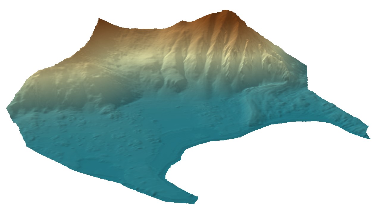
Combined DEM for Fuglebergsletta area from Dornier images and terrestrial laser scanner (TLS)
Digital elevation model (DEM) combined from DEM derived from aerial images captured in 2020 over Hornsund, Svalbard by Dornier aircraft and from terrestrial laser scanner campaign in 2021. Both DEMs contain data gaps; therefore, they were combined to create a continuous product with the best possible accuracy and resolution.
The dataset is the supplement to the paper: Błaszczyk, M.; Laska, M.; Sivertsen, A.; Jawak, S.D. Combined Use of Aerial Photogrammetry and Terrestrial Laser Scanning for Detecting Geomorphological Changes in Hornsund, Svalbard. Remote Sens. 2022, 14, 601. https://doi.org/10.3390/rs14030601
Simple
- Date (Publication)
- 2021-12-22
- Purpose
- scientific and didactic
- Status
- Completed
- Maintenance and update frequency
- Irregular
- Theme
-
- Digital elevation model, Fuglebergsletta
- Place
-
- Hornsund, Svalbard, Norway
- Access constraints
- Copyright
- Use constraints
- Copyright
- Spatial representation type
- Grid
- Metadata language
- English
- Character set
- UTF8
- Topic category
-
- Environment
- Geoscientific information
- Elevation
- Begin date
- 2020-06-22
- End date
- 2021-08-15
))
- Supplemental Information
-
You can customize the template to suit your needs.
You can add
and remove fields and fill out default information (e.g. contact
details).
Fields you can not change in the default view may be accessible in the
more
comprehensive (and more complex) advanced view. You can even use the
XML editor
to create custom structures, but they have to be validated by the
system, so
know what you do :-)
- Reference system identifier
- UTM33X
- OnLine resource
-
DEM for Fuglebergsletta
(
WWW:LINK-1.0-http--link
)
Combined DEM for Fuglebergsletta area from Dornier images and terrestrial laser scanner (TLS)
- Hierarchy level
- Dataset
Overviews
Spatial extent
Provided by
