 Polish Polar DataBase
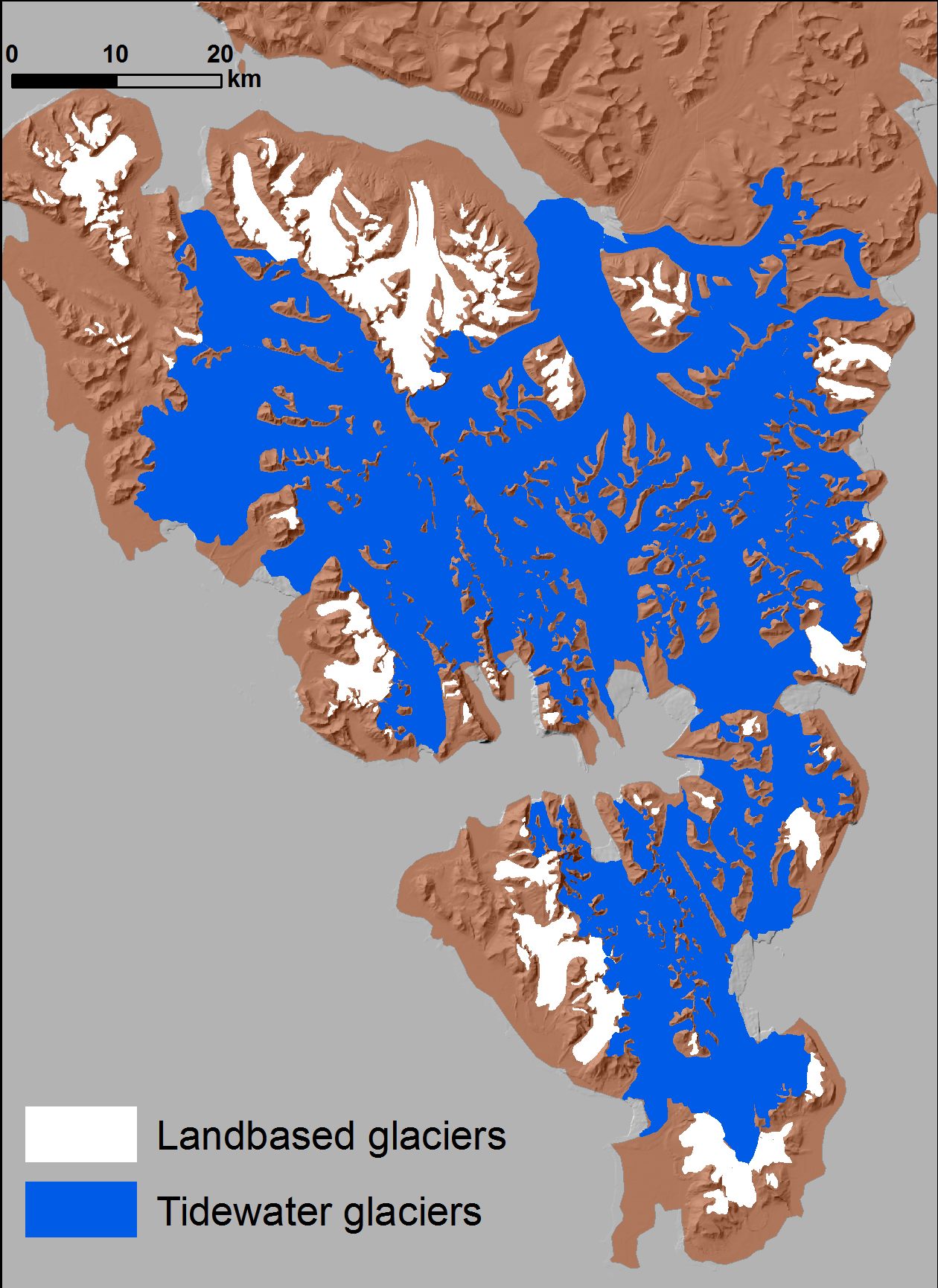
Inventory of glaciers for Southern Spitsbergen - 2010
Inventory of tidewater and landbased glaciers delineated from archival satellite images (ASTER, Landsat) for Southern Spitsbergen. Tidewater glaciers are delineated based on satellite data from 2010. Landbased glacier are extracted from different satellite data (2005-2010). Shapefiles have basic information in the attribute table (name, ID, area, type of glaciers).
Detailed description of the source data and accuracy data for glaciers from hydrological basin of Hornsund can be found in:
Błaszczyk M., Jania J.A., Kolondra L., 2013: Fluctuations of tidewater glaciers in Hornsund Fiord (Southern Svalbard) since the beginning of the 20th century. Polish Polar Research, 34( 4): 327-352.http://journals.pan.pl/dlibra/publication/114504/edition/99557/content
Simple
- Date (Publication)
- 2020-12
- Purpose
- scientific and didactic
- Status
- Completed
- Maintenance and update frequency
- Not planned
- Theme
-
- glaciers, inventory
- Place
-
- Souther Spitsbergen, Svalbard, Norway
- Access constraints
- License
- Use constraints
- License
- Other constraints
- CC BY 4.0
- Spatial representation type
- Vector
- Metadata language
- English
- Character set
- UTF8
- Topic category
-
- Environment
- Begin date
- 2005-07-01
- End date
- 2010-09-30
))
- Reference system identifier
- UTM 33X
- OnLine resource
- Inventory of glaciers for Southern Spitsbergen ( WWW:DOWNLOAD-1.0-http--download )
- OnLine resource
- 2b.zip ( WWW:DOWNLOAD-1.0-http--download )
- OnLine resource
-
Extended human readable information about the dataset
(
WWW:LINK-1.0-http--link
)
Extended human readable information about the dataset
- Hierarchy level
- Dataset
- File identifier
- a0f670ad-0c1e-4cd5-a66d-1366cdfc9428 XML
- Metadata language
- English
- Character set
- UTF8
- Date stamp
- 2020-12-09T11:47:22
- Metadata standard name
- ISO 19115:2003/19139
- Metadata standard version
- 1.0
Overviews
Spatial extent
Provided by
