 Polish Polar DataBase
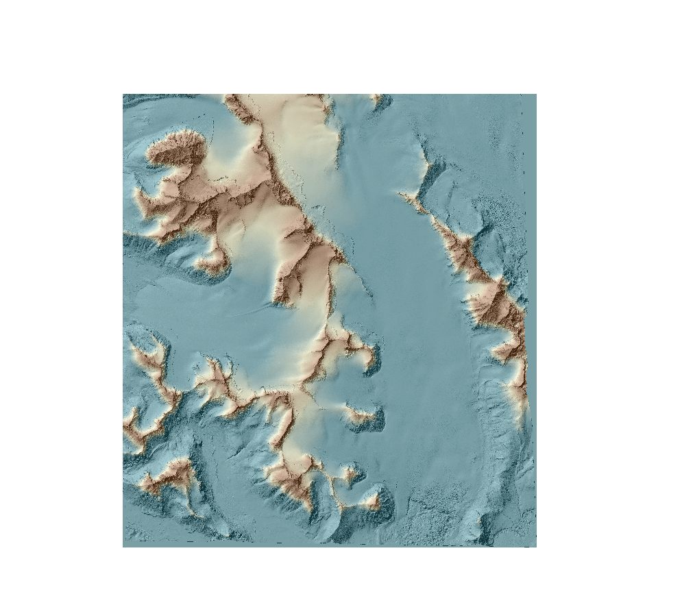
Digital elevation models from VHRS – Hansbreen, Werenskioldbreen and Hornbreen
DEMs from WorldView-2 and Pléaides were extracted using the Rational Function Model (RFM). To improve images orientation, one ground control points (GCPs) was used for each stereo pair. Data format: grid (2m), UTM 33X / EGM 2008. DEMs were developed in OrthoEngine module of PCI Geomatica 2016 with the low level of detail and mountainous type of relief.
Simple
- Date (Publication)
- 2020-12
- Purpose
- scientific and didactic
- Status
- Completed
- Maintenance and update frequency
- Irregular
- Theme
-
- Digital elevation model
- Place
-
- Hornsund, Svalbard, Norway
- Access constraints
- Copyright
- Use constraints
- Copyright
- Spatial representation type
- Grid
- Metadata language
- eng
- Character set
- UTF8
- Topic category
-
- Environment
- Begin date
- 2012-08-15
- End date
- 2017-08-20
N
S
E
W
))
- OnLine resource
- Digital elevation models from VHRS – Hansbreen, Werenskioldbreen and Hornbreen ( WWW:DOWNLOAD-1.0-http--download )
- OnLine resource
- Digital elevation models from VHRS – Hansbreen, Werenskioldbreen and Hornbreen ( WWW:DOWNLOAD-1.0-http--download )
- OnLine resource
-
Extended human readable information about the dataset
(
WWW:LINK-1.0-http--link
)
Extended human readable information about the dataset
- Hierarchy level
- Dataset
- File identifier
- 77c6ce4e-d645-4ccb-9b86-3ac0286a0d49 XML
- Metadata language
- English
- Character set
- UTF8
- Date stamp
- 2021-12-22T19:36:41
- Metadata standard name
- ISO 19115:2003/19139
- Metadata standard version
- 1.0
Overviews
Digital elevation models from VHRS – Hansbreen, Werenskioldbreen and Hornbreen
Spatial extent
N
S
E
W
Provided by

Associated resources
Not available