 Polish Polar DataBase
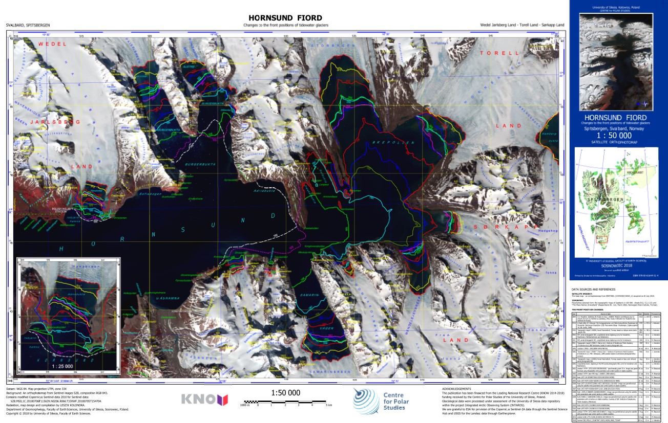
Hornsund Fiord - Changes to the front positions of tidewater glaciers
The ortophotomap of Hornsund Fiord with changes to the front positions of tidewater glaciers. The front positions are based on different cartographical maps and satellite data. The base map is Sentinel 2 satellite image acquired on 6 July 2018.
Citation: Kolondra L., 2018. Hornsund Fiord - Changes to the front positions of tidewater glaciers. University of Silesia, Faculty of Earth Sciences.
Simple
- Date (Publication)
- 2018-12-31
- Purpose
- scientific and didactic
- Status
- Completed
- Maintenance and update frequency
- As needed
- Theme
-
- Place
-
- World
- Access constraints
- Copyright
- Use constraints
- otherRestictions
- Denominator
- 50000
- Metadata language
- eng
- Character set
- UTF8
- Topic category
-
- Boundaries
- Begin date
- 1899-07-31
- End date
- 2018-07-06
N
S
E
W
))
- Reference system identifier
- UTM33X
- Number of dimensions
- 3
- Dimension name
- Row
- Dimension name
- Column
- Dimension name
- Vertical
- Cell geometry
- Area
- Hierarchy level
- Dataset
- File identifier
- 2fbe0b21-4fa5-442f-b0e2-786083a4fe02 XML
- Metadata language
- English
- Character set
- UTF8
- Date stamp
- 2023-05-23T19:18:57
- Metadata standard name
- ISO 19115:2003/19139
- Metadata standard version
- 1.0
Overviews
Spatial extent
N
S
E
W
Provided by

Associated resources
Not available